Hi, I’m a tropy-newbie, just starting to use it and I want to know if it’s suitable for my project.
I want to know if there is a way to view the Latitude/Longitude from picture EXIF in Tropy. I don’t want to modify it, just have these information visualised for each photo.
I’ve just created a custom template, adding the fields for Longitude/Latitude, but doesn’t work. Could be a problem of “Datatype” selection?
Thank You
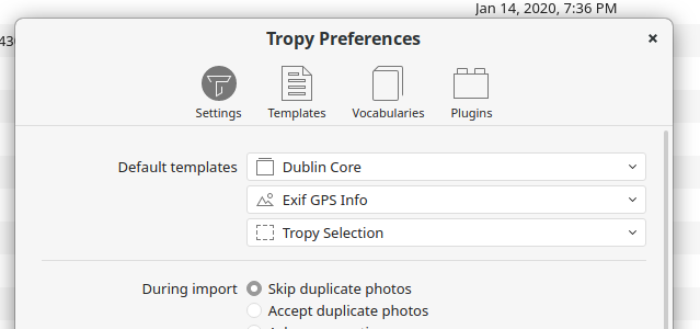
I think you’re doing everything right there, but Tropy will only save those fields when you first import the items (we’re still thinking about a good workflow to extract them later). That means, you need to create a template with all the EXIF tags you’re interested in; then set this template as the default item or photo template (based on where you want the information to go; for EXIF it should typically be the photo level):
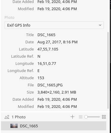
In the screenshot above I set the default photo template to ‘Exif GPS Info’. When I import photos into Tropy now, the fields in my template should be filled (if the respective tags are present). For example: